top of page

Honeoye Lake Watershed Task Force
Bathymetric Maps of Honeoye Lake
The effort to create new Honeoye Lake Bathymetric and Bottom Hardness maps was supported by grant funding from the Ontario County Water Resources Council in 2014. Bathymetry is defined as the depths and shapes of underwater terrain (https://oceanservice.noaa.gov/facts/bathymetry.html) These maps are used by fishermen and scientists to learn more about Honeoye Lake. They allow us to visualize lake conditions and characteristics. To learn more about bathymetric maps, go to: https://www.nationalgeographic.org/encyclopedia/bathymetry/

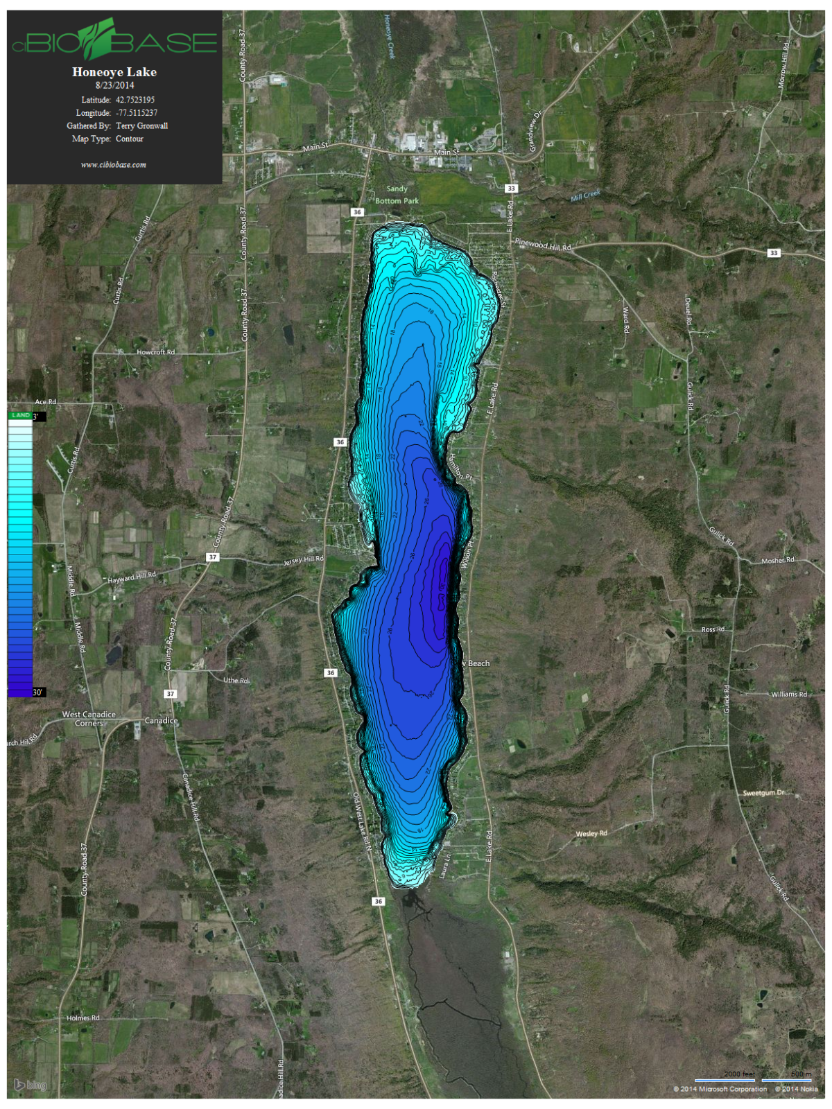
Bathymetric Map of Honeoye Lake with 1 foot Contour Lines
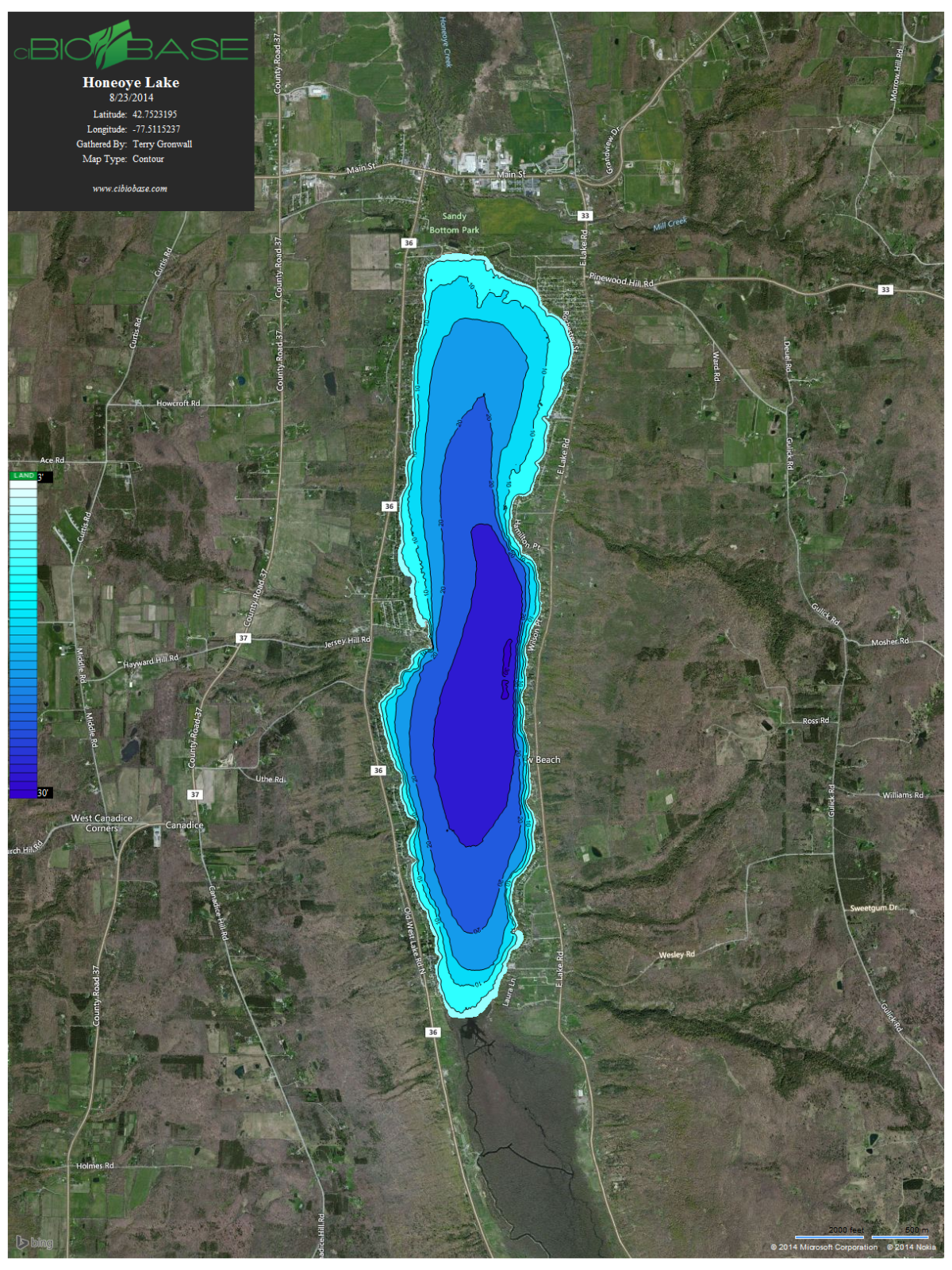
Bathymetric Map of Honeoye Lake with 5 foot Contour Lines
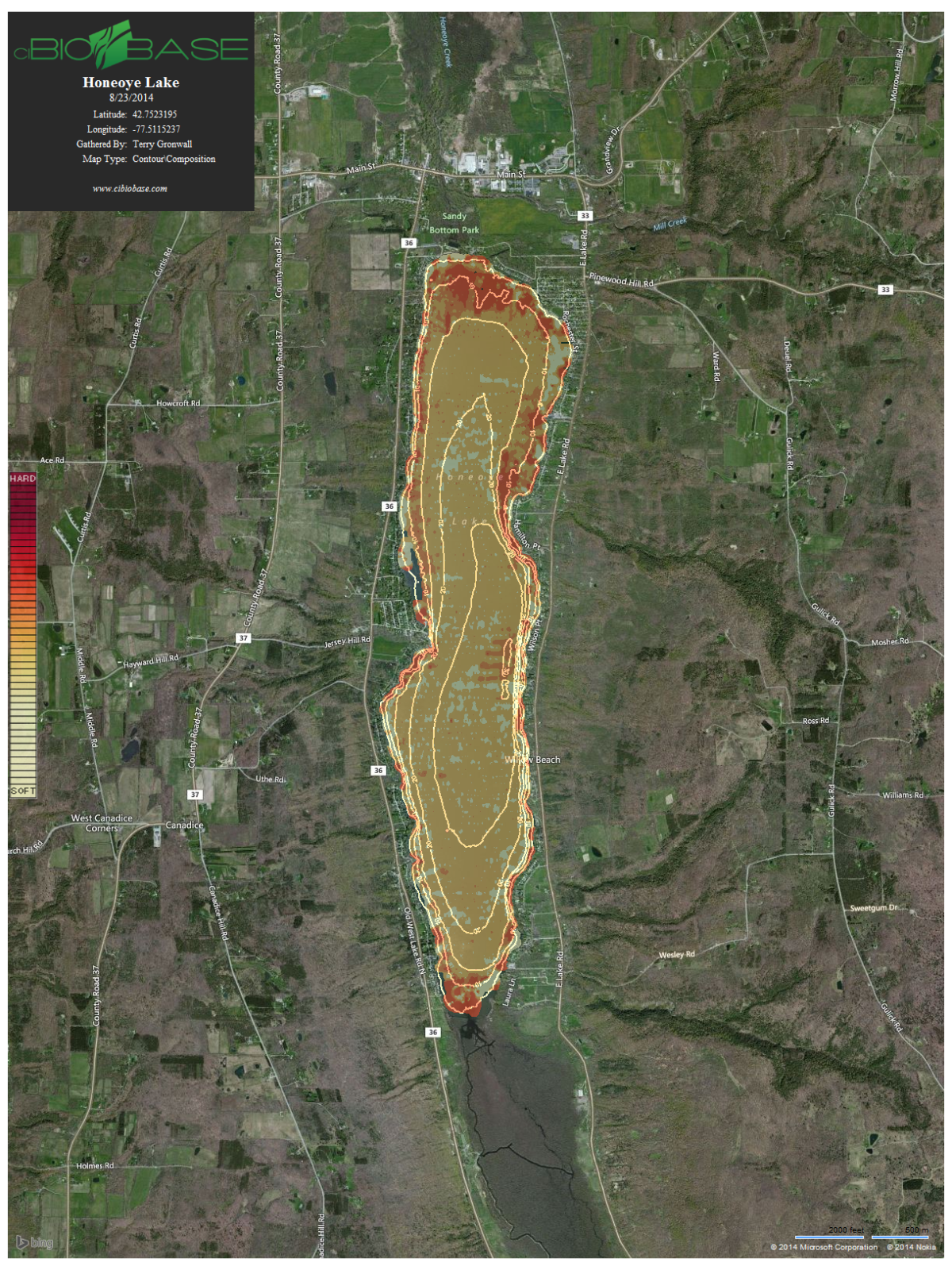
Honeoye Lake Bottom Hardness Map
bottom of page